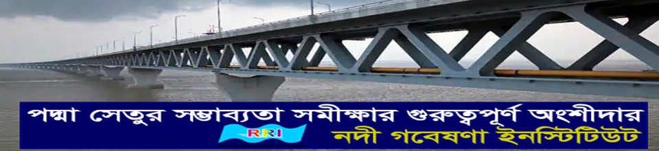
টেকনিক্যাল জার্নাল; ভলিউম-১৫, নাম্বার-১, আগস্ট ২০২০
M.M. Alom1,2 * Dr. M. M. Rahman1 M.M. Rahman3
1Bangladesh University of Engineering & Technology, Dhaka, Bangladesh
2Daffodil International University, Dhaka – 1207, Bangladesh
3Institute of Water Modelling, Dhaka – 1206, Bangladesh
*Corresponding author (E-mail: masud.ce@diu.edu.bd)
Abstract
Riverbank erosion is one of the critical and unpredictable natural calamities in Bangladesh that took place in almost every year. This phenomenon takes into account the quantity of rainfall, soil properties, structural stability, river morphology, topography of river floodplain and monsoon floods. In this study an attempt was made to assess the riverbank erosion at upstream and downstream side (Naria Upazila) of Padma Bridge and tried to identify the possible remedial measures. With the aid of satellite images and GIS software, the bank line over the past four decades (1980 - 2019) were delineated and analysis were made to identify probable impact on life and livelihood at Naria Upazila, Shariatpur, Bangladesh due to river bank erosion. Analysis shows, erosion at downstream is more prominent rather than the upstream of the selected reach. During this period total erosion was occurred at downstream side (Naria Upazila) 2823 meter by length (4456 ha by area) where the maximum erosion was happened 2159 meter in between the year 1988 – 1990. On the other hand, total 1995 meter (2823 ha by area) erosion was measured at the upstream side of the Padma bridge in that time (1980 – 2019) where the maximum erosion was happened in between the year 1990 – 1995. Present trend of river bank shifting will disappear the Naria region within a very short period. In this regards, management should take initiative immediately to adopt techniques that work with the natural processes. To sustain the life and livelihood and reducing the riverbank erosion, structural and non-structural measures should be adopted.
Key words: Riverbank erosion, satellite images, GIS software, remedial measures
PHYSICAL MODELLING OF THE EFFECTS OF STRUCTURAL INTERVENTIONS AND DREDGING AT OFF-TAKE: A CASE SUDY
P. Kanungoe1*, M. A. A. Moududi1, M. J. Islam1, M. Shahabuddin1, S Afrin1, Omar Al Maimun1,
1Hydraulic Research Directorate, River Research Institute (RRI), Faridpur-7800, Bangladesh
*Corresponding Author (Email: pintu_kanungoe@yahoo.com)
Abstract
The Buriganga is the one of most important river flowing beside Dhaka, capital city of Bangladesh of which water quality has been severely deteriorated due to insufficient river flow, dumping of solid waste, disposal of contaminant effluent from different types of industries, especially effluent of tanneries. Feasibility Study of the Buriganga River Restoration Project reveals that augmentation of dry season flow in the Buriganga River is possible by diverting Jamuna river flow through the New Dhaleshwari River. To this end, structural interventions at the New Dhaleshwari will be needed together with capital and maintenance dredging. In order to augment flow in the Buriganga River during the dry season, a physical model study has been undertaken to determine the efficacy of the sedimentation basin, off-take structure and proposed dredging. To fulfil the objectives, a distorted model having a scale of 1:50 for vertical and 1:200 for horizontal is constructed. The model consists of 4km stretch of the (part width) Jamuna River and 10km stretch of the New Dhaleshwari river (full width). The model bed is prepared according to field survey data of Jamuna and Dhaleshwari rivers. The study shows that due to introduction of the guide bunds, intake canal and sedimentation basin, the discharge of the New Dhaleshwari river was increased from 0.85% to 1.71% (725m3s-1) of corresponding dominant discharge of the Jamuna River. However, after lowering (through dredging and as per design) of the river bed downstream of the intervention location New Dhaleshwari discharge became 3.60% (1510 m3s-1) of the dominant discharge of the Jamuna. It is also found that targeted dry season flow (141 m3s-1) augmentation in the Buriganga river is not possible without dredging beyond the intervention location as flood discharge increased by proposed intervention alone is not enough to cause expected lowering of the river bed downstream of the same. Moreover, it is found that the intake canal, sedimentation basin and exit canal would get silted up gradually with time. Annual volume of sediment deposition within the intervention location is 557235m3 and of this volume of sediment, 33% will be deposited within the intake canal, 59% within the sediment basin and 8% within the exit canal.
Keywords: Sedimentation Basin, Dredging, Guide Bund, off-take structure, tailgate, launching apron
M. A. H. Podder1, A.A. Imran1, M.K. Eusufzai, M. N. Rahman1, P. Kanungoe1
1Hydraulic Research Directorate, River Research Institute, Faridpur
Corresponding Author (mdazizul66@gmail.com)
Abstract
River Research Institute has taken up a numerical model study aiming at establishment of the proposed Dirai-Sullah road link and assessment of the devised options to select suitable road alignment and also to determine appropriate type, location and dimension of the road structures in the low laying haor area. At present there is partially completed road link between Dirai and Sullah upazilla headquarters. Establishment of this road link is hampered by the fact that the project area is situated in complex physical and hydrological settings. The study area is hydrologically influenced by the combination of old Surma River and the Champti-Darain River together with many other drainage routes. Rainfall in the adjacent Indian state of Meghalaya largely affects flooding in the study area and the Surma-Kushiyara basin receives water from the transboundary catchments of the Meghalaya, the Barak and the Tripura. A comprehensive hydro-morphological study has been conducted for assessing the existing Madanpur-Dirai-Sullah road (Dirai-Sullah portion) and road structures to determine the appropriateness and adequacy of the existing road alignment and road structures in terms of their sustainability under critical and design hydrological scenarios to suggest appropriate road alignment and type, location, dimension and hydraulic design variables of the proposed road structures, to assess the need for slope protection works and devise their hydraulic design variables. A field survey campaign has been conducted to collect the recent bathymetric and bank line data of the rivers, nearby road alignment and road elevation data, information on existing road structures and physical features in the study area, water level and sediment data etc. as well as DEM of the study area. The study is based on extensive primary and secondary data. A two-dimensional model covering an extent of about 23km of the Champti-Darain River and parts of the Old Surma and other rivers in the study area together with parts of their floodplains has been developed using modelling software MIKE21C. The initial bathymetry of the model is formed by use of the recently surveyed bathymetric data of rivers and topographic data as well as DEM of the study area. The probable discharges and water levels have been identified based on the hydrological data analysis. The model boundary conditions for different returned period discharges have been determined by flood frequency analysis. At some upstream boundaries where measured data were not available, discharge was calculated by slope area method for different return period of flood (20 year and 50 year). The study results shows that the existing Derai-Sullah road alignment except some portion of road and bridge approaches is found to be suitable under likely hydrological and hydraulic conditions. Some portions of the road, the top level of the road is below the design formation level (8.5mPWD). In order to ensure smooth passage of an extreme field discharge one new bridge (103 m) and five new culverts has been suggested with their appropriate locations and dimensions.
Key Words: Haor, Drainage, Scour, Wave runup, Flooding
MANGANESE REMOVAL FROM DRINKING WATER USING ROUGHING FILTRATION
M.M.R.Mondol1*
1 Principal Scientific Officer, River Research Institute (RRI), Faridpur, Bangladesh.
*Corresponding author (E-mail: mrmondol@yahoo.com)
Abstract
Manganese can be removed using the processes of oxidation, precipitation and filtration as in iron removal. Conventionally, a strong oxidant such as chlorine or potassium permanganate is used for oxidation of Mn(II) rather than oxygen alone.Naturally present DO and other constituents (e.g., bicarbonate) in water can promote removal of Mn in a filter media (by sorption and oxidation) without the addition of an oxidant. Two multistage filtration units (MSFU) have been constructed in Sirajgonj to investigate the effectiveness in removing manganese from groundwater adopting the technique of adsorption and co-precipitation of manganese onto the flocs of ferric hydroxide, making use of the naturally occurring iron of groundwater. Observed results indicate that manganese removal is a function of raw water manganese concentration. Higher the Mn concentration, greater is the removal performance. 80-89% manganese removal performance was achieved through this filtration process. Contribution of Down-flow roughing filter (DRF) alone in removing manganese was observed very significant (around 37%). Contribution of aeration, flocculation and sedimentation in removing manganese is around 33%. Contribution of Up-flow roughing filter (URF) in removing manganese is moderate (around15%).
Keywords: Concentration, DRF, effect, filtration, manganese, performance, removal, URF
A CASE STUDY ON PERFORMANCE OF CONCRETE BLOCK MAT FOR RIVER BANK PROTECTION USING SCALE MODELING
A. K. M. Ashrafuzzaman1*, S.K. Das1, S.K. Ghosh1, M.K. Eusufzai1, M. N. Rahman1, E.A. Mondal1
1Hydraulic Research Directorate, River Research Institute (RRI), Faridpur-7800, Bangladesh
*Corresponding Author (Email: ashrafuzzaman_89@ymail.com)
Abstract
This paper presents the findings of the research on Concrete Block Mat (CBM) - an innovative idea produced by Manob Hitoishi Sangstha (MHS) for river bank protection over the river Arial Khan at Ramarpole near Mollarhat bazar of Kalkini upazila under Madaripur district using scale modelling. The river reach of about 1.0 km with an average width about 133m of Arial Khan is reproduced in this research. The research is conducted on an open-air mobile bed of RRI having undistorted scale 1:30 and model is designed to satisfy both flow & sediment transport condition at the same time. In this research, different application test runs are conducted with different test scenarios using low, medium and high flows. The research shows that the proposed technology (CBM) is not so effective as compared to the conventional method though its cost estimate seems to be comparatively less. The construction of concrete blocks, filter placement under water, block placement through the wire etc. are found very complex in the model but in nature it might be more complex. CBM might be very difficult to implement in the field and its construction is time-consuming. It needs special working technology to construct in the field. This concept can be applied in any small river as a pilot project to investigate its effectiveness as well as to identify its complexity in the field.
Keywords: Arial Khan river, concrete block mat (CBM), complexity, effectiveness, river bank protection, scale modeling and technology.
SPATIAL AND TEMPORAL DISTRIBUTION OF HEAVY METALS IN THE BURIGANGA RIVER
F. Rukshana1*, N.C. Ghosh1, M. Moniruzzaman1, K.R. Karim1, M. Shahabuddin2, K.R. Ahmed1, M.M. R. Mondol1
1Geotechnical Research Directorate, River Research Institute, Faridpur-7800, Bangladesh.
2Hydraulic Research Directorate, River Research Institute, Faridpur-7800, Bangladesh.
*Corresponding Author (Email: frukshana11@gmail.com)
Abstract
River pollution is identified as one of the top environmental issues during the couple of decades in Asian region. The Buriganga is considered the most important and polluted river in Dhaka. Disposal of untreated industrial and domestic waste, encroachment and dumping of solid waste have degraded the overall quality of the river Buriganga. The present study investigated the spatial distributions of heavy metals in water at sixteen different sites spread over whole stretch of the Buriganga River (27km). The concentrations of seven metals Cr, Cd, Pb, Ni, Fe, Zn and Cu were analyzed using an Atomic Absorption Spectrophotometer (Thermo-Scientific, 3000 series) in the RRI laboratory. The concentrations were compared with several standard Guideline values provided by different organizations like WHO, DoE, FAO and CCME. The visualization of the spatial pattern of individual metal throughout the Buriganga was primed using ArcGIS 10.3 software. The result showed that the surface water of the whole stretch of the Buriganga was severely polluted by these heavy metals in dry season except Cu and Zn. The statistical analysis showed that a wide variation of concentrations among Cr, Cd, Pb, Ni, Fe, Zn and Cu but slightly differed among the locations. Anthropogenic activities are mainly responsible for elevated levels of the measured metals in river water. The lower concentration of heavy metal was found in post rainy season compared to dry season. Even though the concentration has decreased in post rainy season some severe toxic heavy metals like Cr and Cd concentrations are far above than the safe recommended values. Prevention of metals entering in to the rivers should be enforced to save ecosystem of the watershed environment of the Buriganga.
Key words: Heavy metal, Pollution, Buriganga River, ArcGIS, Spatial distribution, Seasonal variation, Environment, Industrial waste.
P. Kanungoe1*, A. K. M. Ashrafuzzaman1, M. J. Islam1, M.K. Eusufzai1 and M. N. Rahman1
1Hydraulic Research Directorate, River Research Institute (RRI), Faridpur-7800, Bangladesh
*Corresponding Author (Email: pintu_kanungoe@yahoo.com)
Abstract
A hydro-morphological study using numerical modelling techniques was carried out at River Research Institute (RRI) for completion of Wazed Miah Bridge on Karatoya river at 27th km of Sadullapur (Madargonj)-Pirgonj-Nawabgonj Road. The study results show that there is lateral instability problem at the under-construction bridge location and there is a possibility of outflanking of the bridge by the river. Chute cut-off may happen in the bend immediately upstream of the bridge causing large morphological developments at the bridge location. The right bank upstream of the bridge may experience rapid erosion after chute cut-off in the upstream bend which could be a threat for the existence of the right approach embankment. The design discharge and design flood level for bridge and river training works are 2081 m3/s, 26.97 mPWD and 2368 m3/s, 27.21 mPWD respectively. From long-term consideration, bank revetment will be needed on both banks at the bridge location to arrest bank erosion. From consideration of river instability situations at the bridge location and long-term perspective, the minimum length of the bridge (abutment to abutment distance) should be 290m which could be adopted by increasing length of the rightmost span whereas the present bridge length is 278.8m.
Keywords: Bathymetry, bridge, discharge, hydro-morphology, instability, numerical modelling, simulation and water level.
IRRIGATION REQUIREMENTS ASSESSMENT IN A SELECTED IRRIGATION UNIT
A. Akter 1*
1Department of Civil Engineering, Chittagong University of Engineering & Technology (CUET) Chittagong-4349, Bangladesh. http://aakter.weebly.com
*Corresponding Author (Email: aysha_akter@cuet.ac.bd)
Abstract
Better understanding on water management in any irrigation project plays vital role in incremental crop yield. The Karnafuli Irrigation Project (KIP) in the south-eastern region of Bangladesh is a flood control, drainage and irrigation project. The project is well known for its success in achieving irrigation, except few crop damages due to flooding and water logging. Among two units of this project, CROPWAT 8.0 has applied on the Halda unit by using 15 years (1993 to 2007) climate data, considering two scenarios, i.e., rainfed and irrigation. The aim of this study is to estimate total irrigation water requirements (IWR) using CROPWAT. For total IWR estimation, CROPWAT could reasonably represent the soil moist deficit under rainfed and irrigation scenarios. A water balance calculation was carried out to estimate the surplus water, and hence CROPWAT is found to be a useful tool in estimating irrigation requirement against flooding condition. This study is being expected to contribute to the decision process on optimal irrigation supply.
Keywords: Irrigation Water Requirements (IWR), CROPWAT, Halda, Evapotranspiration (ETo), Karnafuli Irrigation Project (KIP).
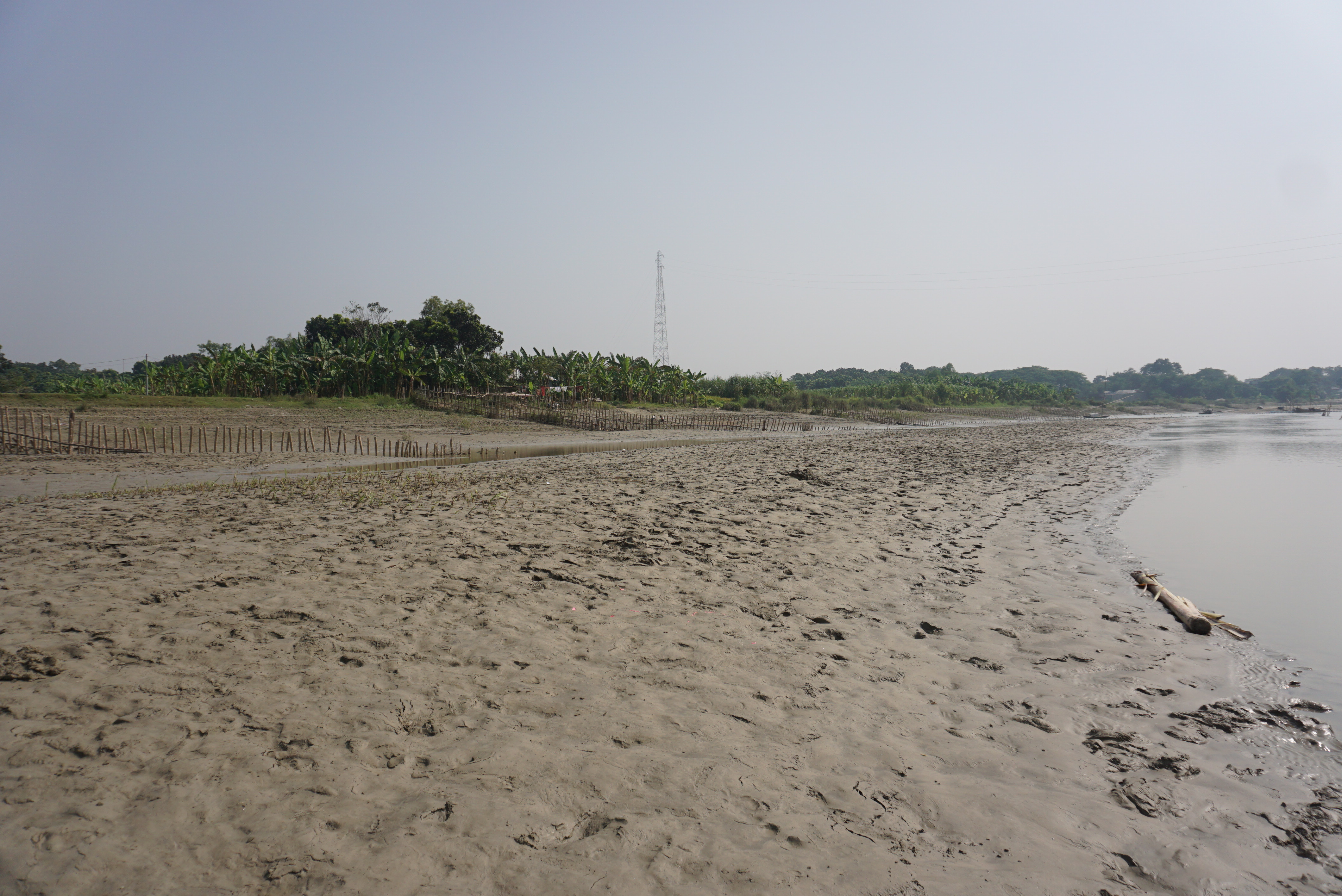
ASSESSMENT OF BANK LINE SHIFTING OF SURMA RIVER USING GIS AND REMOTE SENSING APPROACH
G. M. Munna1*, M. J. B. Alam1, M. M. Uddin1, H. Rahman2, P. K. Deb3, F. H. Himel3 and M. Arif 4
1 Faculty, Department of Civil & Environmental Engineering, Shahjalal University of Science & Technology, Sylhet.
2 Country Director, Concern Worldwide.
3 Executive Engineer, Bangladesh Agricultural Development Corporation (BADC), Sylhet Region.
4 Ex-Student, Department of Civil & Environmental Engineering, Shahjalal University of Science & Technology, Sylhet.
Abstract
River and Drainage System the rivers of Bangladesh are very extensive and distinguish both the physiography of the country and the life of the people. Bangladesh is called a land of rivers as it has about 700 rivers including tributaries. This study has been conducted to assess the bank line shifting of Surma River using Remote Sensing and GIS approach in light of the recent outbreak of erosion in many rivers in Bangladesh. Landsat Satellite images of 1994, 2006, and 2018 have been collected based on study area. ERDAS IMAGINE 2014 and ARC GIS 10.3.1 have been used to analyze the satellite images. A number of 23 places between Dowarabazar and Golapgonj of Sylhet district have been selected for study area to easily perceive the order of erosion of the river in those corresponding places. Kalaruka, Dowarabazar, Dakshin Kushighat have been found as the most vulnerable places and Haripur, Chatak, Mollapara have been found as the least vulnerable places due to the river bank erosion within our fixed time frame. Also, most erosion has been found at the bends of the river, the fact, which has been also emphasized in this study.
Keywords: Surma River, Remote Sensing, GIS, Landsat Satellite, River Bank Erosion.
A STUDY ON GEOTECHNICAL CHARACTERIZATION OF RED SOIL OF DHAKA CITY OF BANGLADESH
U. Saha1*, M. Moniruzzaman1 N. C. Ghosh1, S. Ferdoush1, K. R. Karim1, S. K. Das1
1 Geotechnical Research Directorate, River Research Institute (RRI), Faridpur-7800, Bangladesh
*Corresponding Author (e-mail: umasaha_65@yahoo.com)
Abstract
Generally red soils characters are different from other soils. In Bangladesh, a very few red soils are characterized in geotechnical point of view. However, it is necessary to massive study on it. From this point of view, a study has been undertaken to characterize the red soils from their properties which assist the engineer for design of structure of foundation on red soil and same strata of red soil in other area. From this study the iron concentration have been found about 27.8% for red soils with 38% clay whereas soils with 4% clay contain iron concentration of about 12.9%. That is soils containing high percentage of clay have more iron and manganese concentration in compare with soils containing low percentage of clay. The pH values have been varied from 5.6 to7.026. It indicates the soils are strongly acidic and sometime it is neutral. The natural moisture content varies from (8.90-28.99)% whereas plasticity ranges from (28-32)% and shrinkage limit varies from 7% to 22%.The consistency ranges from stiff to very stiff and the red soils have contained particles sand (12-25)%, silt (39-49)% and clay (26-39)%. The dry density of these soils varies from (14-16) kN/m3 and the specific gravity of the cohesive soil varies from (2.675- 2.684) and of the non-cohesive soil varies from (2.642-2.653). The study finds that the natural moisture content is not adequate to fulfill engineering needs. Plasticity as well as stiffness of red soil should also be considered to draw engineering attention for construction works.
Keywords: Dhaka city, Red soils, geotechnical characterization, iron content, alkali content.
M.H. Masum*1, J. Hossen2 and S.K. Pal3
1PG Student, Chittagong University of Engineering & Technology, Bangladesh,
2Student, Chittagong University of Engineering & Technology, Bangladesh
3Professor, Chittagong University of Engineering & Technology, Bangladesh
*Corresponding Author (e-mail: mehedi.ce.cuet@gmail.com)
Abstract
Unplanned urbanization along with city’s changed landscape causes urban drainage changes and also fall short maintaining its capacity. This study therefore aims to evaluate the performance of drainage pattern under different land use and climatic conditions. Mahesh khal is taken as a study area, a major drainage canal connected with Karnaphuli River. This study analyses land use pattern of the study area with the data collected through field investigation and also gathered from the secondary sources using GIS tool. Chattogram city holds monthly average rainfall of around 243 mm and therefore totalling 2919 mm in a year which is about to increase 5% - 6% by the year2030. Out of total 8.59 square kilometres of total land areas 5.12 square kilometres areas of land occupied as vegetation and open areas which was about 60% of the total area in 1988 but unfortunately within the 30 years of time span the areas lost its 28% of the vegetation and open. Moreover the peak discharge found for 2, 5, 10, 25, 50 and 100 years return period were 19.8, 29.4, 35.8, 44.1, 50.4 and 56.5m3s-1. The study also found that the peak discharge decreases with the increase of Roughness values because the canal with high roughness values indicates high weeds which will give more resistance than a clear canal. The results also revealed that peak discharge increases with the increase of Curve Number (CN) value and percent (%) impervious which indicates that landuse changes has great impact on urban drainage runoff as CN value and percent (%) impervious are related with landuse patterns of the urban areas.
Keywords: CN, HEC-HMS 4.2, ArcGIS 10.4, Runoff, impervious, rainfall etc.
FLOOD MODELING OF THE SURMA-KUSHIYARA RIVER BASIN USING HEC-HMS
M. S. Basir1*, P. Dutta1 and M. R. A. Mullick2
1Department of Water Resources Engineering, Chittagong University of Engineering and Technology, Chattogram- 4349, Bangladesh
2Professor, Department of Civil Engineering, Chittagong University of Engineering and Technology, Chattogram- 4349, Bangladesh
*Corresponding Author (Email: msbasirwre@cuet.ac.bd)
Abstract
Flood modeling and simulation helps in anticipating flood events thus can minimize flood damage. This study simulated flood occurrences at Surma-Kushiyara river basin which is situated at the north-east part of Bangladesh. Digital elevation model (DEM) of the study areas was used in ArcGIS 10.3 interface to delineate basin, sub-basin and stream networks. With the help of HEC-GeoHMS hydrologic parameters of the river basin such as basin slope, basin area, river length etc were extracted from DEM. These extracted hydrologic parameters were applied to imitate the rainfall-runoff model using HEC-HMS. In this study model has been calibrated for two years and validated for one year. Surma-Kushiyara river basin and upper Surma-Kushiyara river basin has been calibrated for the years of 2009, 2010 and validated for the year of 2011.In addition, to check the efficiency of the results, statistical evaluation was also performed. The study had generated an inclusive description of the basin with decent precision and the R-squared value of the rainfall-runoff model for the Surma-Kushiyara river basin and upper Surma-Kushiyara river basin was found to be 0.93 and 0.79 respectively. This study concludes that rainfall-runoff model using HEC-HMS gives satisfactory result of flood simulation in the Surma-Kushiyara river basin.
Keywords: Digital elevation model, flood, HEC-GeoHMS, HEC-HMS, Rainfall-Runoff model, statistical evaluation.
SEDIMENTATION OF HARI-TEKA RIVER OF THE POLDER SYSTEM IN THE SOUTHWEST REGION OF BANGLADESH
M. M. A. Masud1* and A. K. Azad2
1National Training and Rehabilitation Center for the Blind (NTRCB), Employment and Rehabilitation Center for the Physical Handicapped (ERCPH), Department of Social Services, Station Road, Tongi, Gazipur, Bangladesh
2Environmental Science Discipline, Khulna University, Khulna- 9208, Bangladesh
*Corresponding Author (Email: md.mahedi.am@gmail.com)
Abstract
The rivers of the Southwest region in Bangladesh carry a large amount sediment to build up the Bengal delta. The process of sediment deposition and erosion is significant for measuring the rate of sedimentation of a tidal river in delta management. Polder system of the Southwest region isolates the tidal river from the floodplain, which hampers natural sediment management by delta development, and advances waterlogging in the floodplain by creating drainage congestion of the river. The study identifies Hari-Teka River of the Southwest region to measure the rate of sedimentation. It follows the sounding pole method to calculate the depths, and cross-sectional area method to estimate the cross-sections of this river at Chahera and Sholgatia of Dumuria upazila under Khulna district, and Kopalia of Manirampur upazila under Jashore district. This research finds that the rate of sedimentation of Hari-Teka River was 0.43 m3m-2year -1 that was annually 29% regarding the total cross-sectional area. This result has policy implications to remove drainage congestion of the river, and decline waterlogging from the floodplain by facilitating Tidal River Management (TRM) for the sustainable delta management.
Keywords: sedimentation, Hari-Teka River, Polder, waterlogging, Tidal River Management (TRM), Southwest region.
A. K. M. Ashrafuzzaman1*, S.K. Das1, M. A.A.Moududi1, T. Nahar1, S.K. Ghosh1, P. Kanungoe1
2Hydraulic Research Directorate, River Research Institute (RRI), Faridpur-7800, Bangladesh
*Corresponding Author (Email: ashrafuzzaman_89@ymail.com)
Abstract
This paper presents the results for finalization of the proposed dredging alignment & design, performance of the bank revetment for bank protection and effectiveness of the required river training works for land reclamation in the Padma river around Jajira & Naria upazila under Shariatpur district using scale modeling. The river reach of 36.0 km of Padma upstream of Padma-Meghna confluence at Chandpur and the river reach of 15km upstream & 5km downstream of confluence along the Meghna have been reproduced in this study. Different application test are conducted with different test scenarios (introducing revetment, dredged channel & T-head groynes) using different discharges. The total length of dredged channel is 11.8 km. It was found that dredged channel is mostly found to be silted up. It is also found that the dredged channel is partially silted up at average annual discharge (30,000 cumec) but at 100-year return period discharge (1,30,000 cumec), it is almost fully silted up. Therefore, if it is intended to maintain the proposed dredged channel, regular maintenance dredging would be required. At the end of the test, the percentage of siltation on average is measured about 70% fully silted of its length (at the upstream) and the rest part partially silted (at the downstream). The proposed revetment (9.35km) tested in different tests works well and it is recommended to implement in the field. It is necessary to implement the bank revetment in the field immediately for the protection of the problem area and to prevent the bank erosion in the coming year. The location, alignment, dimension and spacing of groynes tested in the recommended test is suggested to implement in the field as it provides better result. The proposed groynes are expected to divert the flow towards the mid-stream and to facilitate land reclamation by sedimentation between the groynes.
Keywords: Padma river, bank protection, dredging, optimization, river training works and land reclamation.


গুরুর্তপূর্ন লিঙ্ক সমূহ
- পানি সম্পদ মন্ত্রণালয়
- বাংলাদেশ পানি উন্নয়ন বোর্ড
- পানি সম্পদ পরিকল্পনা সংস্থা
- বাংলাদেশ হাওড় ও জলাভূমি উন্নয়ন অধিদপ্তর
- যৌথ নদী কমিশন
- জাতীয় নদী রক্ষা কমিশন
- দুর্নীতি দমন কমিশন
কেন্দ্রীয় ই-সেবা
মানচিত্র
ভিডিও

জাতীয় সংগীত

সামাজিক যোগাযোগ

ইনোভেশন কর্নার
জরুরি হেল্পলাইন নম্বর
